![2021-02-21 21_33_18-Autodesk AutoCAD 2021 - [1520ElcadoreCir7_PC_1.0.dwg].jpg](https://images.squarespace-cdn.com/content/v1/5f559a6dd6a3865a30bedfc6/cd475b67-9b25-4324-b441-7f08da04c3a0/2021-02-21+21_33_18-Autodesk+AutoCAD+2021+-+%5B1520ElcadoreCir7_PC_1.0.dwg%5D.jpg)
High Definition Laser Scanning
What is High Definition Laser Scanning? What are Point Clouds? See the animated Fly-throughs and still images below of local Anchorage sites to see for yourself. Subscribe to the Data Point Design YouTube Channel for future animations and videos.
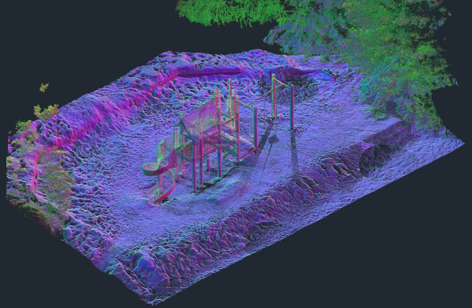
High Definition Laser Scan of park playground equipment with normal mapping color scheme.
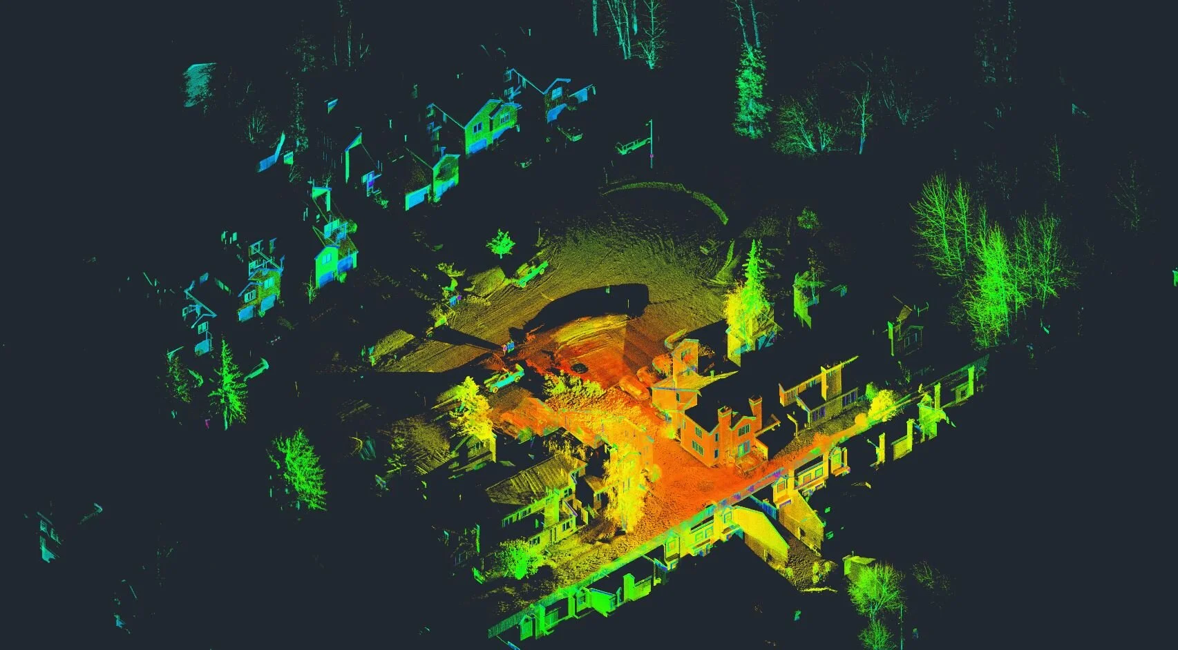
High Definition Laser Scan Data of a residential neighborhood.

High Definition Laser Scan of a residential unit.

High Definition Laser Scan, Ortho Elevation of residential unit.
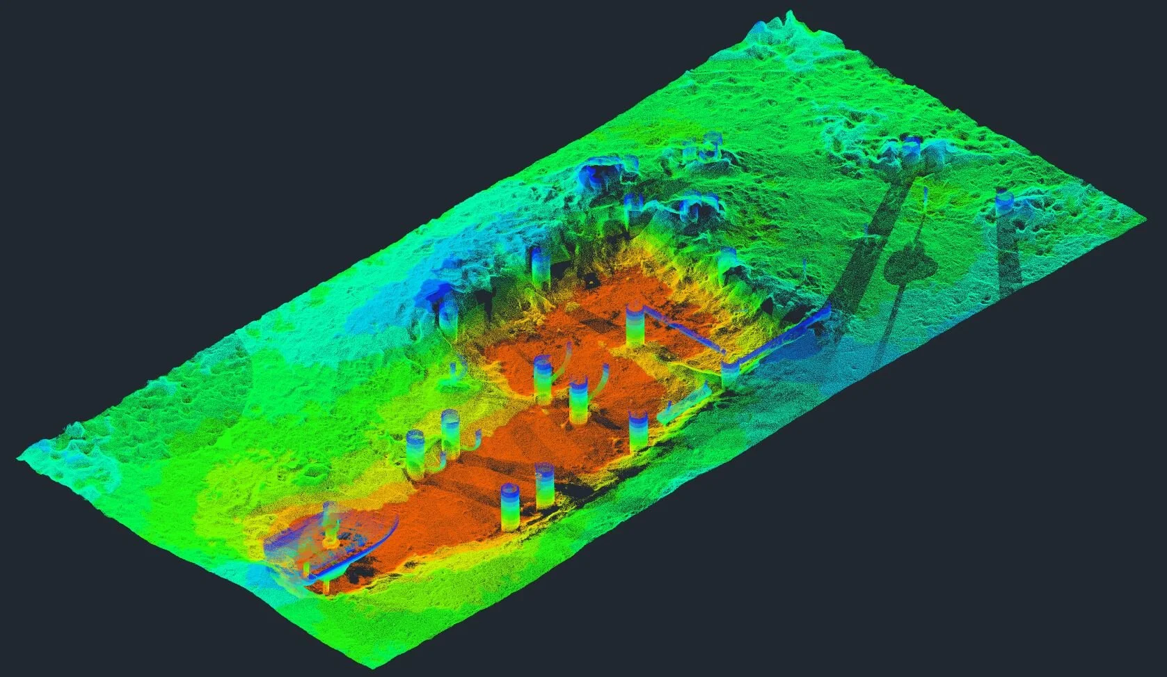
Section through point cloud data of playground equipment with elevation color scheme.
Web Based Point Cloud Viewer using Potree
Point Cloud Data
Click inside the embedded viewer to examine a small point cloud dataset.